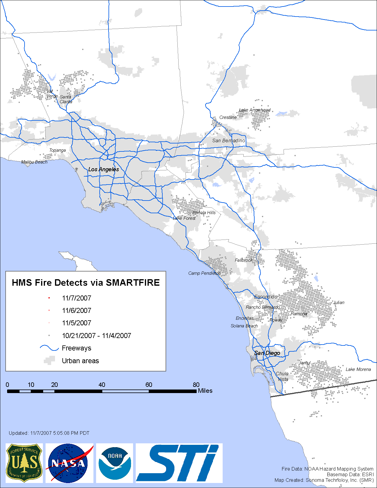
Fire Map
This map shows fire detects from satelltes over the past several days as gathered by the SMARTFIRE system from the reported NOAA HMS satellite based fire detects (see below). Each fire satellite detect is shown as a separate dot, with color coding indicating the date of the detection. Updates are provides several times a day (3-4 hours). The time of the update is indicated on the map. This map is provided through a private/federal government/university partnership between Sonoma Technology, Inc., the US Forest Service's AirFire Team, and the Desert Research Institute's Climate, Ecosystems, and Fire Applications program.
The SMARTFIRE system
SMARTFIRE, which stands for Satellite Mapping Automatic Reanalysis Tool for Fire Incident Reconciliation, is an algorithm and database system that combines multiple sources of fire information and reconciles them into a unified data set. Fire information is available from a variety of sources including satellite SMARTFIRE ingests fire information from reports from incident commanders on the ground and satellite-detected fires from the National Oceanic Atmospheric Administration's (NOAA) Hazard Mapping System (HMS). HMS fires are created by combining detections from seven satellites and applying manual quality control by a trained satellite analyst.
SMARTFIRE produces daily high-resolution estimates of the locations and sizes of wildland fires. The SMARTFIRE estimates are transmitted to the BlueSky smoke modeling framework, which translates the fire information into information on the quantity and location of smoke downwind of the fires. The SMARTFIRE system was created as a federal government/private collaborative partnership between the USDA-Forest Service's AirFire Team and Sonoma Technology, Inc. with funding from NASA.
For more information, please contact:
Dana Sullivan
Sonoma Technology, Inc.
707.665.9900
Sim Larkin
USDA Forest Service AirFire Team
larkin@fs.fed.us
206.321.2013