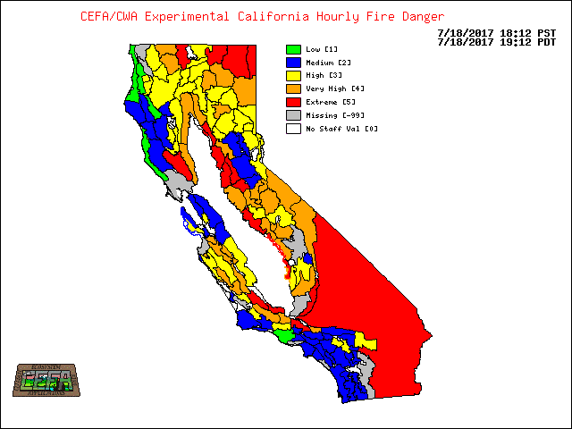
To find out more information about each Fire
Danger Rating Area (FDRA), click on a part of the map to zoom in closer, or try it out in Google Maps.
The map is roughly divided into thirds (northern,
central, and southern
California). This product is experimental and uses National Fire Danger Rating System (NFDRS) equations adapted to generate standard NFDRS output without human intervention. The Hourly Map values may be utilized as a guide to fire danger conditions but should not be used by themselves for decision processes.